Avenir Light is a clean and stylish font favored by designers. It's easy on the eyes and a great go-to font for titles, paragraphs & more.
Avenir Light is a clean
The Full Story
About Fairway Springs
I think that it would be a wonderful idea to collect, collate, digitize and host here, any historical documentation about Fairway Springs.
If you have any documentation from the builder / developer, any photo's or video footage or any promotional materials related to the community, send them to President@fairway-springs.com and I'll include them here.
Fairway Springs Storm Drain Maps
The image below, shows the locations of the drains in our community and the direction of travel of the water between the drains and the ponds.

Fairway Springs Plat Map
This image (below) is the plat map for the Fairway Springs community. A plat is a cadastral map, drawn to scale, showing the divisions of a piece of land. United States General Land Office surveyors drafted township plats of Public Lands Surveys to show the distance and bearing between section corners, sometimes including topographic or vegetation information.

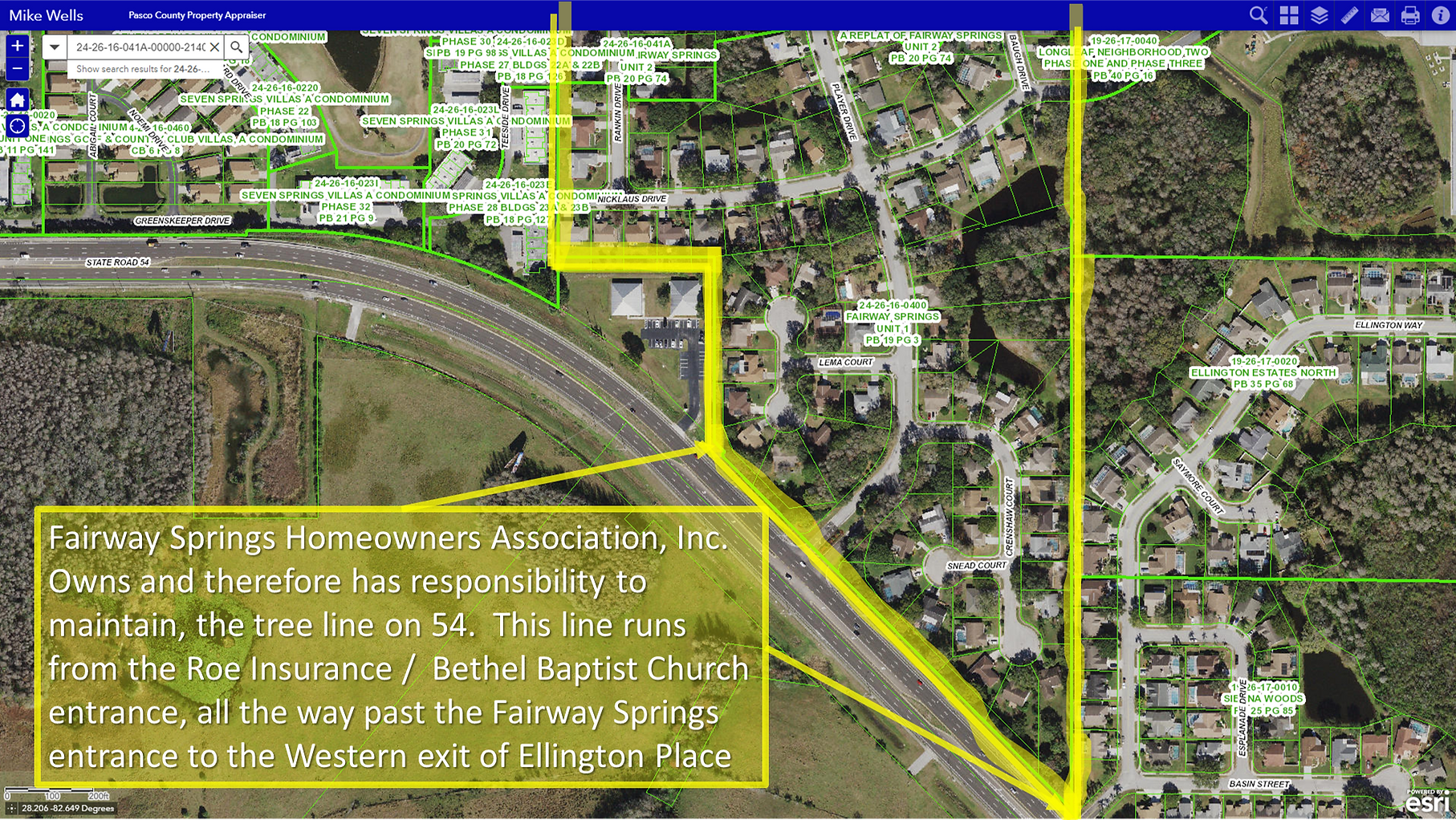
Fairway Springs Boundary Flora & Forna Responsibility